Hi, I am Kostas
a Remote Sensing Geoscientist & Engineer
Education
Work Experience & Training
Education
- MSc. Geoscience & Remote Sensing | Delft University of Technology, Netherlands | 2016-2019
- BSc. Geology | University of Patras, Greece | 2010-2015
Work Experience & Training
- Research associate | Center for Research & Technology Hellas, Greece | 2021-present
- Web Design & RDBMS trainee | APOPSI, Greece | 2020
- Data Science Intern | Deltares, Netherlands | 2018-2019
Software & Programming
- Python
- Bash
- ESA SNAP
- QGIS / ArcGIS
- Matlab
- ERDAS Imagine
- ImageJ
- SQL
Additional:
- GNU / Linux
- Docker
- Adobe Photoshop, GIMP
- Sony Vegas
- Audacity
- HTML / CSS / Bootstrap
- MySQL, MS Access
Competencies
- Machine Learning
- Deep Learning
- Feature Engineering
- Time series and Image Classification
- Image (semantic) segmentation
- Spatial statistics / Geostatistics
- Outlier detection
- EO data acquirement
- Multi-temporal Optical / SAR processing
Projects

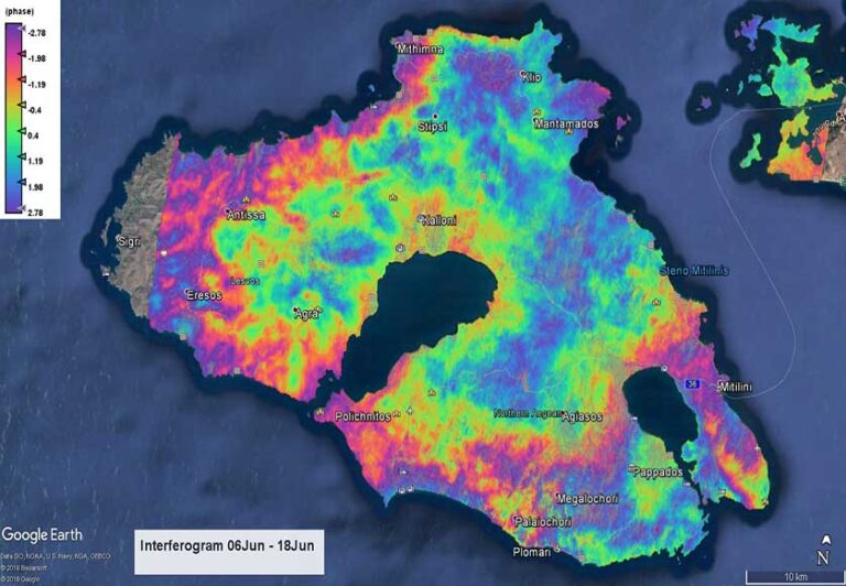
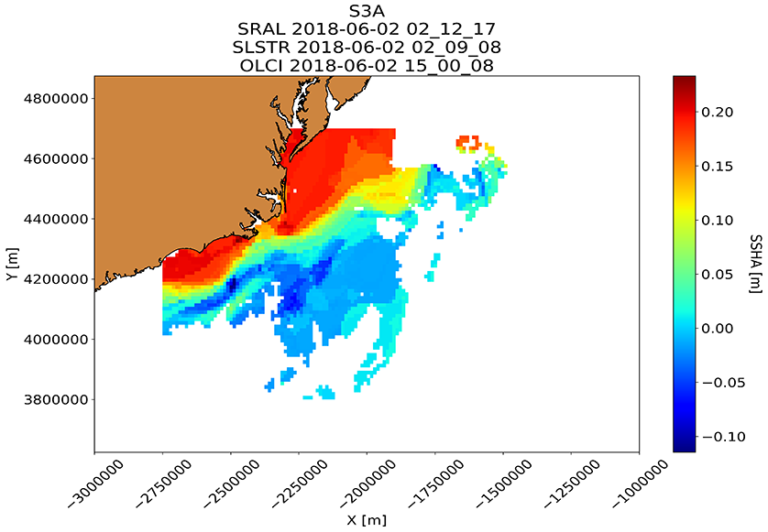
AI-based Sentinel-3 fusion for sea level estimation
Individual (MSc thesis)

Geospatial ecological analysis based on fieldwork data
Individual (BSc thesis)

Crop water requirements monitoring using Sentinel-2 and Landsat-8
Individual (MSc)

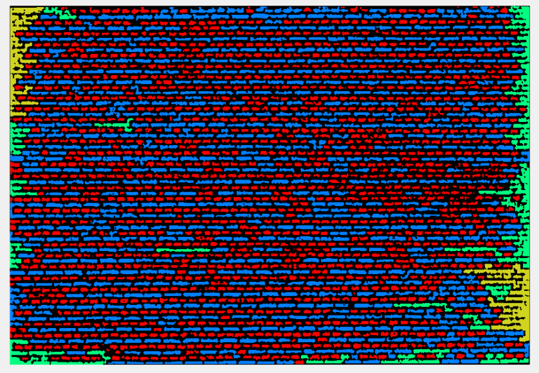
Object-based church stone extraction from Lidar data
Group (MSc)

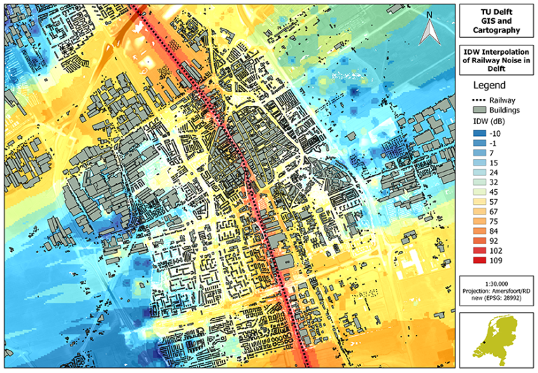
Spatial dispersion modelling of railway in GIS
Group (MSc)

Deformation analysis with Sentinel-1 InSAR
Group (MSc)
Explore. Learn. Map the Future.
The gEOsphere Learning Hub is your gateway to geospatial education and training. Dive into interactive courses, grow your GIS skills, and join a community of spatial thinkers.